


PERRY, Boone County, Indiana
About
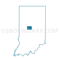
Outline

Summary
| Unique Area Identifier | 576442 |
| Name | PERRY |
| County | Boone County |
| State | Indiana |
| Area (square miles) | 20.84 |
| Land Area (square miles) | 20.82 |
| Water Area (square miles) | 0.02 |
| % of Land Area | 99.93 |
| % of Water Area | 0.07 |
| Latitude of the Internal Point | 39.94924090 |
| Longtitude of the Internal Point | -86.40722620 |
Maps


Graphs
Select a template below for downloading or customizing gragh for PERRY, Boone County, Indiana


Neighbors
Neighoring Voting District (by Name) Neighboring Voting District on the Map
- BROWN 01, Hendricks County, IN
- BROWN 03, Hendricks County, IN
- BROWN 08, Hendricks County, IN
- CENTER 16, Boone County, IN
- CENTER 6, Boone County, IN
- EAGLE 10, Boone County, IN
- EAGLE 10 WHITESTOWN, Boone County, IN
- EAGLE 19, Boone County, IN
- EAGLE 19 WHITESTOWN, Boone County, IN
- HARRISON, Boone County, IN
- MIDDLE 02, Hendricks County, IN
- WORTH, Boone County, IN
- WORTH 02, Boone County, IN
Top 10 Neighboring County Subdivision (by Population) Neighboring County Subdivision on the Map
- Eagle township, Boone County, IN (21,977)
- Center township, Boone County, IN (18,030)
- Brown township, Hendricks County, IN (11,593)
- Middle township, Hendricks County, IN (6,170)
- Worth township, Boone County, IN (2,454)
- Perry township, Boone County, IN (1,163)
- Harrison township, Boone County, IN (704)
Top 10 Neighboring Place (by Population) Neighboring Place on the Map
Top 10 Neighboring Unified School District (by Population) Neighboring Unified School District on the Map
- Brownsburg Community School Corporation, IN (40,258)
- Zionsville Community Schools, IN (24,334)
- Lebanon Community School Corporation, IN (21,647)
- North West Hendricks Schools, IN (9,688)
- Western Boone County Community School Corporation, IN (9,426)
Top 10 Neighboring State Legislative District Lower Chamber (by Population) Neighboring State Legislative District Lower Chamber on the Map
- State House District 40, IN (94,412)
- State House District 87, IN (80,568)
- State House District 28, IN (69,656)
- State House District 38, IN (66,895)
Top 10 Neighboring State Legislative District Upper Chamber (by Population) Neighboring State Legislative District Upper Chamber on the Map
- State Senate District 24, IN (162,120)
- State Senate District 21, IN (141,992)
- State Senate District 23, IN (125,346)
Top 10 Neighboring 111th Congressional District (by Population) Neighboring 111th Congressional District on the Map
Top 10 Neighboring Census Tract (by Population) Neighboring Census Tract on the Map
- Census Tract 8106.03, Boone County, IN (11,559)
- Census Tract 2101.04, Hendricks County, IN (7,950)
- Census Tract 2103, Hendricks County, IN (6,245)
- Census Tract 8103, Boone County, IN (5,520)
- Census Tract 8106.01, Boone County, IN (4,811)
- Census Tract 8107, Boone County, IN (4,598)
- Census Tract 2101.03, Hendricks County, IN (3,651)